Saba
 Our sail of 35 miles to Saba was again a very easy sail with light winds and 1 meter seas. The next island after St. Kitts was St. Eustatius (Statia), which we decided to bypass as we are now half way through our adventure and much less than half the distance we need to cover by the end of May. At the northern tip of Statia we enjoyed maneuvering through 7 large anchored oil tankers. Statia is home to a large storage depot for oil from around the world. Smaller ships take the oil from here and deliver it where required.
Half way between Statia and Saba we were greeted by our best ever dolphin show. It started with quite a few tail slaps and continued for at least an hour with dolphins weaving across our bows. We sat on the cross bar dangling feet in the water until Alex came up with the idea that they should put the climbing harness on and dangle more than their feet. So this was what happened. They had hoped to be able to touch the dolphins but they managed to keep out of hand reach.

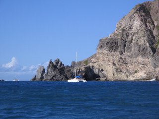
We anchored on the northwest side of Saba in one of the few allowed anchorages. Most of the area around Saba is Marine Park. Ron headed off to clear customs and Donna and I were quick to get in the water to check out the snorkeling. Even though there was a northerly swell stirring up the sand, which lowered the visibility we had a great snorkel. We saw many Black Durgeon, Cow Fish, Blue Chromis, huge Stoplight Parrot fish, Hawksbill Turtles and some species we still are working on identifying. We managed to get in quite a few snorkels while anchored at this spot.
Saba is the last of the “Islands that Brush the Clouds”; it is a very unique island that is only 5 square miles and reaches to a lofty 3000 ft. When you look at Saba from the water one can hardly understand why anyone would live on this rock. But once on Saba we discovered it was as unique as it was beautiful. We toured Saba with Billy, a third generation Sabian. He was able to take us on the road that couldn’t be built, according to the Dutch engineers who inspected it for
 the citizens of Saba. One of the citizens who didn’t agree took a correspondence engineering course and supervised the hand building of this road over a period of forty years. Prior to the completion of this road the only way in and out of Saba was via the 800 stairs cut into the hillside. The two main villages are Bottom & Windwardside. Bottom is not at the bottom at all which I found quite amusing. The towns and streets were spotless with the road maintenance staff hand sweeping the streets every morning. After the completion of the road that couldn’t be built the island wanted to put in an airport and again was told it wasn’t possible. so they again proved them wrong and built the entire strip by hand. The main planes using the airport are Twin Otters built in Canada and the landing here is compared to landing on an aircraft carrier (only 400 meters long). (picture is the painting inside the church in Bottom)
Billy asked us if we were going to take the hike up Mt. Scenery which is stated to have 1064 stairs. Alex started the ball rolling with saying she would do the hike and not to be outdone by a 14 year old we took on the challenge. Ron of course had to see how quickly he could do it and left the girls and me behind. In the end we all made it to the top where we were in a cloud forest in the clouds. Though Ron tells us he did catch the most amazing view before the clouds rolled in. The hike was probably the most aerobic exercise that any of us had done since we left and a few of us felt it the next couple of days.


0 Comments:
Post a Comment
<< Home